
Commercial industrial waste recycling site
Objective and outcome of the task
This task was to fly over a commercial industrial recycling site, and to gather survey quality images to be used by a surveying practice in estimating the volumes of stock piles of recycled industrial waste.
The mapping missions were flown as planned and without any technical or operational issues. The 2D maps presented below show some variation in site elevation and in the broad characteristics such as vegetation & feature colours when zoomed out, but most of the differences are only visible when zoomed in.
The ortho mission took just under two hours (including GCP placement & measurement, and several battery & memory card changes) to cover 94,000 sqm (9.5 hectares/23 acres) capturing approx 800 photos.
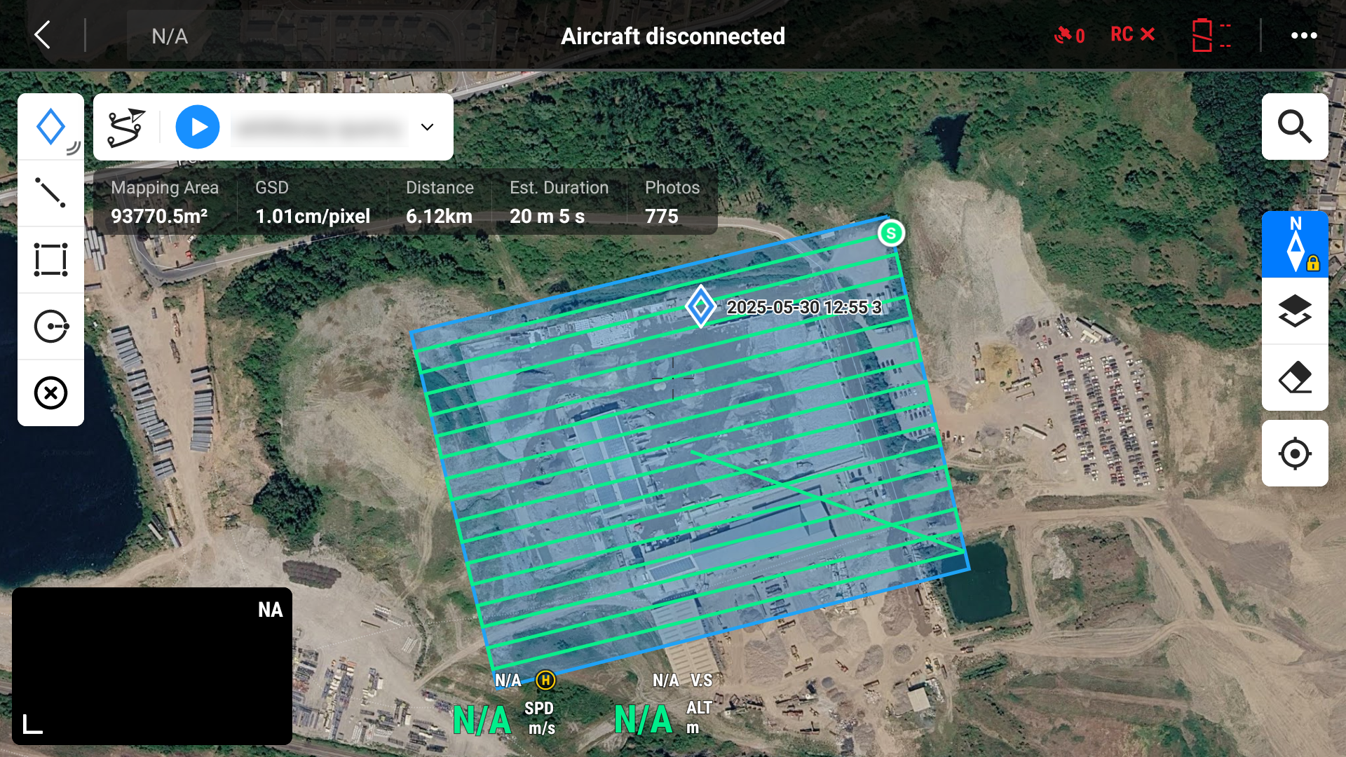
Mission plan - ortho only flight
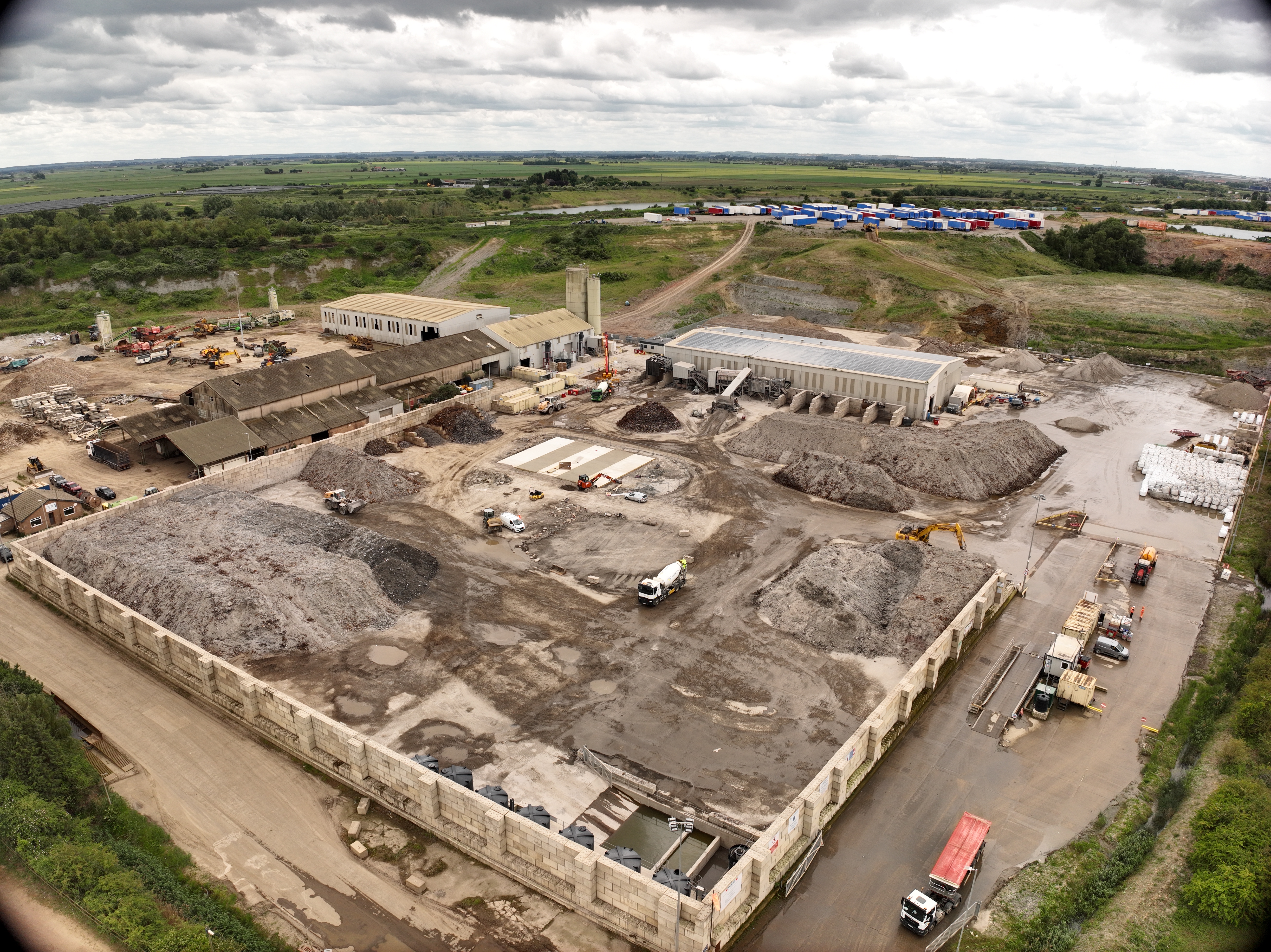
The mission was flown at 37m agl and 5.1m/s ground speed taking approximately 7 minutes. Several site overview and panorama images were captured to help the customer gain a quick understanding of the status of the recycled material stockpiles and the overall site condition.
Several site overview and panorama images were captured to help the customer gain a quick understanding of the status of the recycled material stockpiles and the overall site condition.
Ground Control & Check Points
Five GCPs were set or marked on the hard surfaces at the boundary & centre of the site area of interest and measured using the GNSS RTK rover prior to the mission being flown.
Photogrammetry & geo-referencing
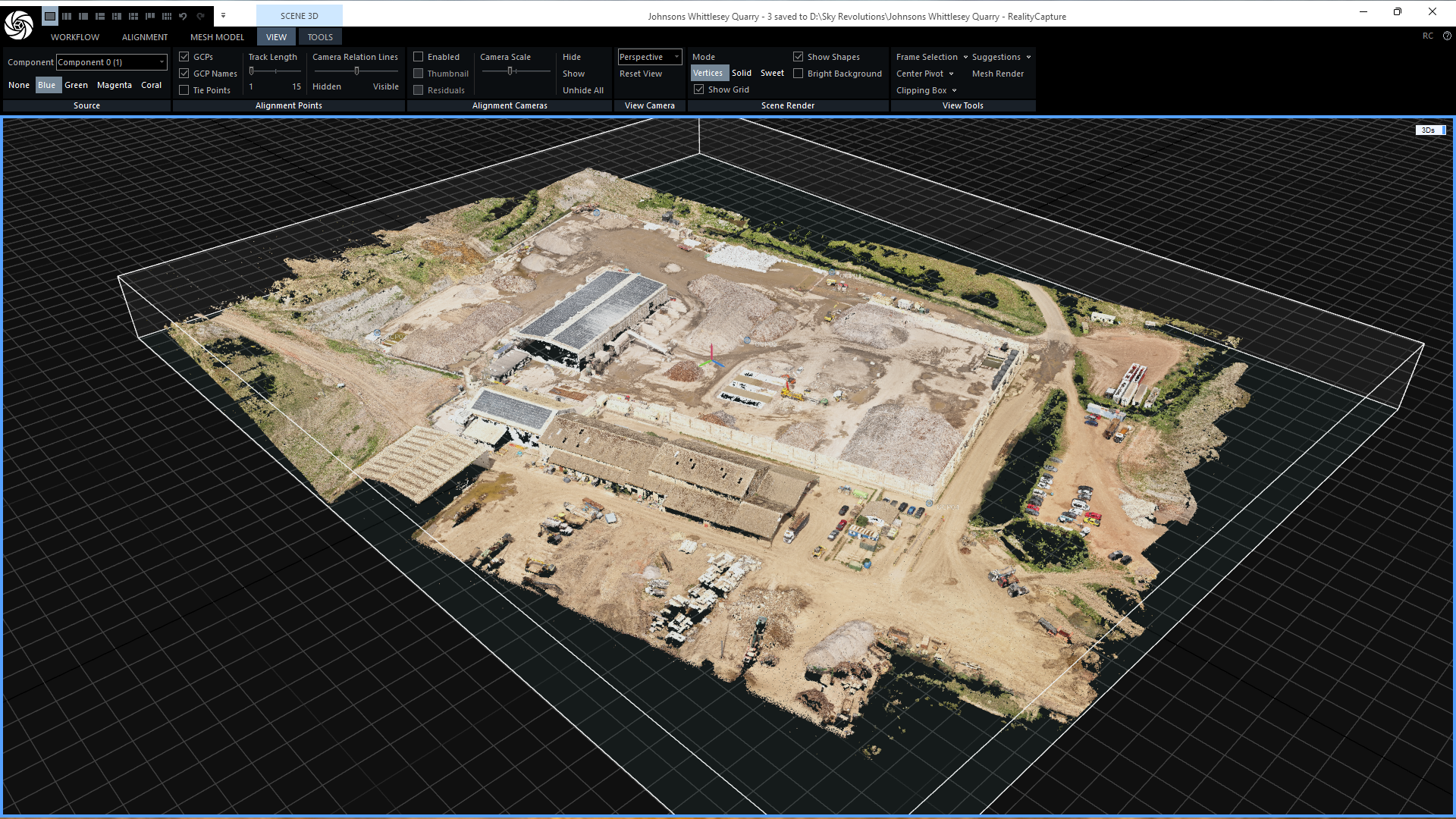
The raw drone survey images and GCPs were processed using Reality Capture & QGIS, taking just over 5 hours of processing time to create the ortho photo & DTM and an hour on QGIS to create the contour map, and running on a Windows 11 PC with a 32-core Intel Core i9-14900 processor, 64GB of RAM and an Nvidia 4060 GPU.
The raw drone survey images and GCPs were processed using Reality Capture & QGIS, taking just over 5 hours of processing time to create the ortho photo & DTM and an hour on QGIS to create the contour map, and running on a Windows 11 PC with a 32-core Intel Core i9-14900 processor, 64GB of RAM and an Nvidia 4060 GPU.
Drone survey 3D model during image & GCP processing
2D Map outputs
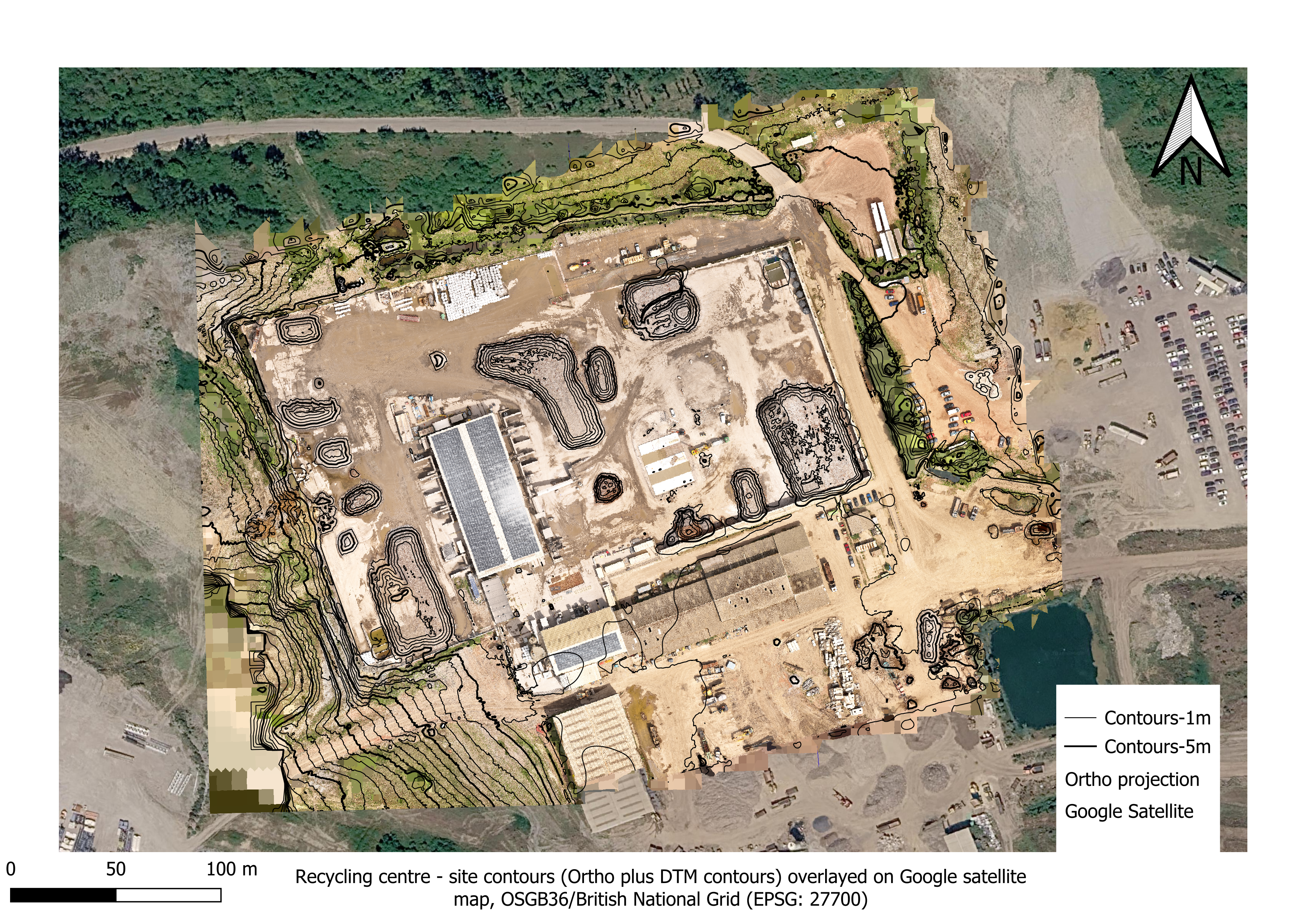
A 2D orthophoto and digital terrain model (DTM) was output by Reality Capture as GeoTIFF files. The orthophoto GeoTIFF was used to create a layer in QGIS, then contour lines were extracted from the DTM to create another layer using a QGIS built-in function and over-layed onto the orthophoto image. A Google Maps base-layer was added for context and to indicate the precision of the raw drone survey images & photogrammetry processing.
Drone survey deliverable output orthophoto plus contour lines
3D model & animation
This video file shows a screenshot of a manual animation of the model in the Reality Capture software. The 3D model can also be output to a number formats compatbile with various CAD, GIS, etc. apps.)

If you are interested in any of our services click here to email us
Airborne Insights is a trading name of Logistics Partners Consultancy Limited